Participatory Land Use Planning (PLUP)
Participatory Land Use Planning (PLUP) is a rights-based approach ensuring inclusive and gender-responsive land governance, especially for those whose rights to land are not fully acknowledged.
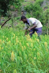
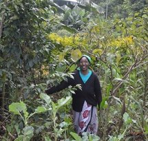
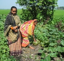
All over the world, indigenous groups, rural communities, small-scale farmers, pastoralists, women and young people experience difficulties in accessing and using land and securing land rights. In many non-Western countries, indigenous, rural, and remote communities recognise and exercise communal land rights that are often poorly defined or ignored by official land administration systems. At the same time, global investment in commercial agriculture and land-based infrastructure is expanding and often involves the use or acquisition of large areas of 'vacant' land.
When the rights of local communities to use, manage and hold their lands are not clearly defined or recognised, or where the formal land planning system does not reflect the reality of indigenous peoples and local communities, these investments carry a risk of limiting, denying or violating local communities' rights and potentially 'grabbing' indigenous, customary or communal lands in contradiction to international human rights law. In addition, sustainable land management practices such as agro-ecological land use, analog forestry or farmer-led re-greening are under pressure from these large-scale developments, while such sustainable land use practices are becoming increasingly important to combat climate change, deforestation and desertification.
Participatory Land Use Planning (PLUP)
These developments illustrate the need for alternative, inclusive and participatory approaches to land governance. Participatory Land Use Planning (PLUP) is one such approach, which aims to empower communities to assert their rights to use, own and manage their lands (especially customary and communally-managed lands); both in practice and in local and national policy dialogues. It can be used to prevent or resolve land use conflicts, to defend against land grabs, to plan for the sustainable management of natural resources, or to provide a framework for inclusive land-use decision making.
PLUP aims to bring together top-down land use planning and bottom-up community empowerment processes within a rights-based framework that focuses on the recognition, protection and enjoyment of communal land rights.
Securing land rights for local communities
Enhancing the security of land rights and land access for local land users and communities is a key focus in the PLUP approach. Strengthening local people's rights to access and use land provides a foundation for communities to plan and invest in sustainable land-use practices. Recognition of local people's land rights and security of land tenure also provide an institutional shield against unwanted interference from external actors who do not fully respect the rights of local land users. In turn, sustainable land-use practices and collective land-based enterprises also provide an economic and social buffer against land grabs and the acquisition of communal lands by corporate actors.
Local land users and communities are empowered in PLUP processes to identify and enunciate their rights to land in the language of local and international laws, manage and plan the use of their land according to their social, cultural and economic values with a long-term perspective, and to integrate these aspirations in land-use planning and decision-making processes.
Implementing PLUP
How Participatory Land Use Planning is implemented depends on the local context. The process may start with awareness-raising on the importance of PLUP with local land users, communities and authorities, for example through community workshops. Local land users, communities and local authorities might also need to be trained in community mapping techniques, especially in gender-sensitive and gender-responsive mapping and planning processes.
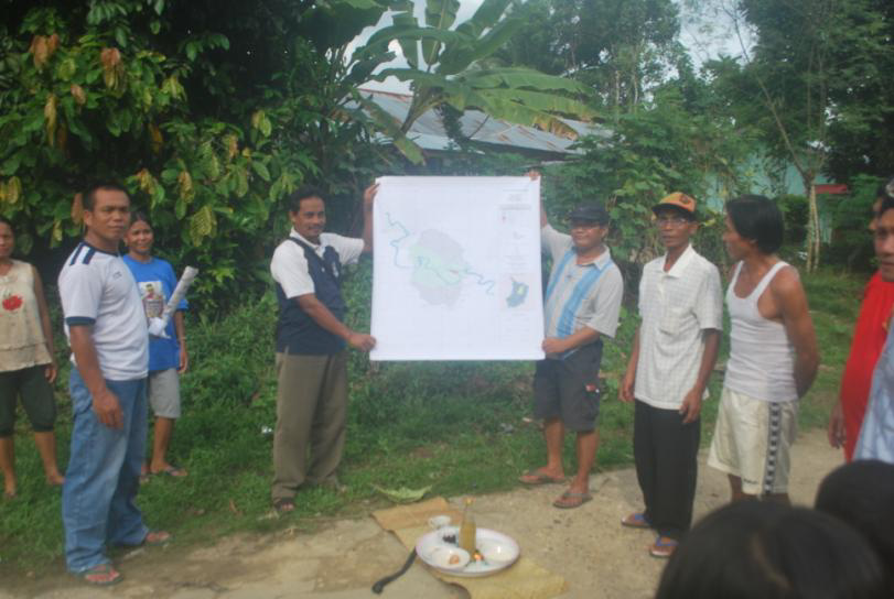
Often an important step is the actual mapping of land rights and land-use zones at the village level, which can include mediation and resolution of conflicts over land rights, boundaries and land-use entitlements with adjacent land users. Once there is consensus on the area where a community's land rights exist - as depicted on a map - and what those rights entail, the community is able to make informed decisions about how their lands should be used.
At the same time, local and regional authorities need to be involved. Where possible, PLUP activities aim to be aligned with spatial planning policies, in order for the village-level land-use map to be integrated into formal land-use plans. This calls for advocacy at all government levels (local, regional, national) to create an enabling environment for official recognition of PLUP processes, community-produced land tenure maps, and - ultimately - the rights and interests in land that communities assert during these processes.
Both ENDS and PLUP: working with community organisations
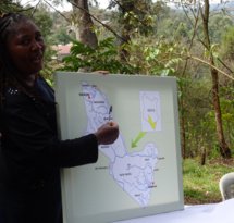
Both ENDS supports local CSOs to develop the capacity of local communities to defend and assert their land rights through PLUP activities, and to upscale PLUP in regional, national and international policies. For example, together with our partners in Indonesia we conducted a pilot project in West-Kalimantan, aiming to facilitate the integration of community maps into formal district-level spatial planning procedures. Land-use planning in Indonesia is based on formal maps that make no mention of customary and village boundaries. This makes communities vulnerable to land-grabs and displacement, as oil palm companies may expand their plantations onto community land without the consent of the local people who use (and claim) this land. The PLUP project successfully put participatory land-use planning and community mapping on the agenda of the district government. The district government publically announced its commitment to the demarcation of Rural Areas based on locally produced community maps, in order to safeguard the interests of local communities. The impact this had on local communities is shown in the short film Mapping our Future.
In Kenya, the efforts on PLUP in the Tana Delta led to a full fledge land use plan which was established in a joint process with local communities, authorities and NGOs. Furthermore, a few years ago we started a PLUP project in two communities in Monze district, Zambia. After community meetings in 2017, follow-up steps were planned to strengthen the community maps by facilitating the process to clarify the land tenure of families. Also some community members indicated the PLUP process lead to an open conversation within families about the division of land between husbands and wifes, resulting in parts of the land being given to the women.
PLUP: an innovative solution for sustainable land governance
By ensuring that land-use planning processes are people-centered and driven by the goals, values and interests of the community whose land is under threat, the PLUP approach offers an innovative solution to local land governance challenges.
Both ENDS therefore intends to build and share experiences of PLUP, develop an inventory of tools, organise seminars and other fora, assist other community-based organisations in applying these tools and insights to their own situation and build the case for incorporating inclusive, participatory and gender-sensitive land mapping and governance practices into conventional national and international land-use planning processes.
Themes

Read more about this subject
-
Transformative Practice
Inclusive Land Governance
Both ENDS works with partners around the world to ensure that land is governed fairly and inclusively and managed sustainably with priority for the rights and interests of local communities.
-
Dossier
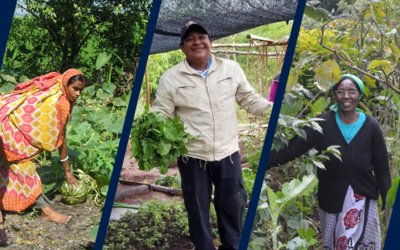
Inclusive ways to sustainable and healthy food for all
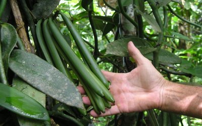
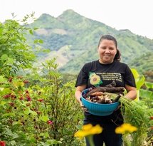
All around the world small-scale farmers are using sustainable and inclusive methods to produce food. Working together with nature and each other, they provide their families and communities with sufficient and healthy food. But their production methods are under pressure from large-scale agriculture and the globally dominant system of industrial food production. Together with our partners, Both ENDS is trying to turn the tide in favour of sustainable, local practices that are mostly known as 'agro-ecological' or 'nature-inclusive'. Why are we focusing on these methods? Agro-ecological practices are climate-proof and inclusive and increase the opportunities for communities around the world to produce their food sustainably.
-
Dossier
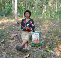
The merits of community-based restoration
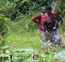
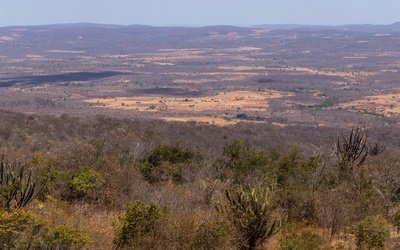
Globally, the area that is suffering desertification and land degradation is ever expanding. Unsustainable and often large-scale agricultural practices, including the copious use of pesticides and fertilisers, are a major driver of land degradation, aprocess that is further exacerbated by climate change, causing more erratic rainfall patterns, longer periods of drought and unpredictable growing seasons. This is very problematic not only for the hundreds of millions of people who directly depend on land and water for their livelihoods, but also for life on earth as a whole. It is clear that this process must be stopped and reversed, better sooner than later. But how to go about it?
-
Dossier
Rich Forests
Rich Forests promotes a sustainable and future-proof production system and supports, among other things, the transformation of degraded land into food forests. With this, people provide for their livelihood, increase their income and at the same time restore soil and biodiversity.
-
Dossier
Communities Regreen the Sahel
In various countries in the Sahel, vast tracts of land have been restored by the local population by nurturing what spontaneously springs from the soil and protecting the sprouts from cattle and hazards.
-
News / 13 October 2023
Water is life, water is food: World Food Day 2023
"Water is life, water is food" is this year's theme for World Food Day. Our partners around the world know all too well that this is a very true sentence. To celebrate World Food Day 2023 this October 16th, we'd like to show a few examples of how our partners fight for the right to water and this way, contribute to local food sovereignty at the same time.
-
Press release / 21 April 2023
Manifesto: The Netherlands can reduce its international footprint with new Agricultural Agreement
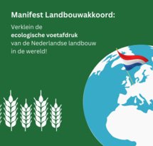
The Dutch Agriculture Agreement, which is currently under development, is too much focused solely on the Netherlands. That is the opinion of a broad coalition of more than sixty NGOs, farmers' organisations, scientists and companies that have today sent an urgent letter to agriculture minister Piet Adema and foreign trade and development minister Liesje Schreinemacher. The government's agricultural policy should also aim to reduce the Netherlands' enormous agrarian footprint beyond our borders, by taking food security and the preservation of biodiversity as its starting points. The coalition has published a manifesto in which it sets out how reform of the Netherlands' foreign agricultural policy could be given shape.
-
Press release / 7 March 2022
New report: investment in agroecology necessary for healthy global food system
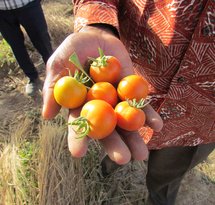
A recent study by Profundo for Both ENDS and Oxfam Novib shows that investment in agroecology is necessary for a sustainable and inclusive global food system. Today, some 768 million – one in ten – people suffer from hunger or a severe shortage of food on a daily basis. Conflict, economic stagnation caused by the Corona epidemic, and the climate crisis present an immediate threat to the production of and access to sufficient nutritious food. Agroecology, a form of agriculture that places small-scale farmers, the natural environment and short supply chains at the centre of food production, makes communities in developing countries more resilient and helps them combat hunger. The study concludes however that major donors, including the Netherlands, are so far providing insufficient support for agroecology.
-
Event / 7 December 2021, 14:00 - 15:15
WEBINAR: EU's push for strong Intellectual Property Rights (IPR) on seeds
The European Union's (EU) foreign trade policy has many implications for the sustainability of food systems in developing countries, heavily impacting farmers, breeders, and citizens. The unhidden promotion by the EU of strong intellectual property rights on plants affects food systems from its very basis, i.e., the seeds that are available for farmers to grow. Amongst these intellectual property rights, the main instrument that is advocated by European authorities is the 1991 Act of the UPOV Convention, which provides exclusive rights to breeders over the propagating material of new plant varieties, while diminishing the rights of others to use the material for further breeding and hampering with the rights of farmers to freely save, use, exchange and sell their seeds.
-
Publication / 29 November 2021
-
News / 30 September 2021
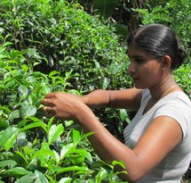
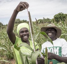
Agroecology in Kenya: fighting water pollution while securing food production
About 75% of Kenyans earn all or part of their income from the agriculture sector which accounts for 33% of the country's Gross Domestic Product (GDP). However, agricultural productivity has stagnated in recent years. Various factors have contributed to low agricultural productivity, including an overall decline in soil fertility because of the continuous removal of nutrients by crops; poor farming practices; land degradation and overuse/misuse of synthetic fertilizers that acidify the soil. The solution against these problems is: agroecology.
-
News / 27 September 2021
Analog Forestry: sustainable food production with a feminist perspective
In times of ecosystem degradation, deforestation and climate change, rural communities often struggle to make a living in a healthy and autonomous way. One of the solutions to counter their problems is Analog Forestry, a sustainable practice promoted by many of Both ENDS's partners. We spoke to Carolina Sorzano Lopez*, Analog Forestry trainer from Colombia for the International Analog Forestry Network (IAFN), and Luz Marina Valle*, a local Analog Forestry promotora in her community of El Jocote in Northern Nicaragua, to explain to us the advantages of Analog Forestry.
-
News / 17 September 2021
Beyond trees: the importance of Non-Timber Forest Products for communities
About one in every six people, particularly women, directly rely on forests for their lives and livelihoods, especially for food. This shows how important non-timber forest products (NTFPs) and forests are to ensure community resilience. Not only as a source of food, water and income, but also because of their cultural and spiritual meaning.
-
News / 19 August 2021
Violet Matiru: “Communities around colonial Ruiru I Dam still struggle”
After many years of advocating for strong environmental policies at international platforms such as the UN, Kenyan Violet Matiru asked herself: "How does all this lobbying trickle down to our communities? How does this help our mothers who are still struggling with fetching water and cooking on wood stoves?" This is when she and her colleagues founded MCDI Kenya (Millennium Community Development Initiatives) and started to work with local communities. We talked to her about the historical and current power imbalance in water governance and her efforts to improve water governance in the Athi River basin, that runs all the way from upstream of Nairobi, through the city, into the Indian Ocean.
-
News / 13 August 2021
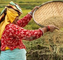
Food sovereignty in the polders of Southwest Bangladesh
The situation in the southwest delta of Bangladesh is critical. Because of sea level rise, floods are increasing and the area is about to become uninhabitable, despite Dutch-style dikes and polders built in the previous century. Partner organisation Uttaran works with local communities on climate-friendly solutions that restore the living environment and give the inhabitants a say about their future and food production.
-
News / 29 June 2021
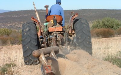
Fighting desertification in the Brazilian Sertão
The farmers in the Sertão do Araripe region in Pernambuco state are smart. The small-scale family farmers know that securing a sustainable livelihood on the rich but vulnerable soils of the Sertão is only possible if they take good care of the environment. That means sound agriculture, making the best of every drop of available water, diligent use of natural fertilisers and pest-control and fighting for laws and policies that stimulate conservation rather than exploitation. The organisation CAATINGA helps the farmers to face the challenging conditions.
-
News / 20 June 2021
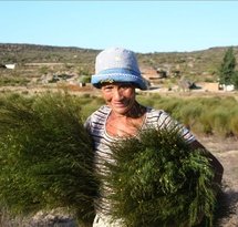
Organic wild rooibos in South Africa’s dryland
South Africa is the home of rooibos, an ancient, health giving herbal infusion, discovered thousands of years ago by the KhoiSan, indigenous peoples of the Southern part of Africa. During the last century, rooibos has been increasingly commercialised, mainly by white South African farmers who produce it on a very large scale, causing environmental damage, soil erosion and loss of biodiversity. Fortunately, small-scale, environmentally sound and community-led rooibos cultivation initiatives also exist. Our long-standing South African partner Environmental Monitoring Group (EMG) has, for more than two decades, been involved in this type of rooibos cultivation with the communities in the Suid Bokkeveld, in the western part of South Africa. Although it was not always easy, Noel Oettle, senior advisor at EMG, thinks this way of producing is the future.
-
News / 17 June 2021
Celebrating community led initiatives on World Desertification, Land Degradation and Drought Day
Today is World Desertification, Land Degradation and Drought Day. Such a day is more than needed to get attention for desertification, land degradation and drought that are threatening and hitting hundreds of millions of people in many regions throughout the world. While the causes - such as large-scale agriculture, use of pesticides, water extraction and climate change - are clear and need to be stopped, it is just as important to focus on solutions like restoration and sustainable land use.– in line with World Desertification, Land Degradation and Drought Day's theme for this year: 'Restoration. Land. Recovery. We build back better with healthy land', we will therefore especially focus on inspiring solutions during the next few weeks.
-
Publication / 8 January 2021
-
Blog / 25 September 2017
Bringing good practice to the UNCCD conference
Access to, ownership and control over land is inherently part of a successful implementation of land degradation neutrality (LDN) and sustainable land management. Sustainability often means investing for the long term, and insecurity withholds land users to do so. In particular women's land use rights are fundamental as they are the ones working on the land and thus putting LDN into practice.